Baie-Comeau
Baie-Comeau | |
|---|---|
City | |
 Hotel Le Manoir | |
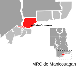 Map of RCM with Baie-Comeau highlighted | |
 Baie-Comeau Location in Côte-Nord region of Quebec. | |
| Coordinates: 49°13′N 68°09′W / 49.217°N 68.150°W / 49.217; -68.150Coordinates: 49°13′N 68°09′W / 49.217°N 68.150°W / 49.217; -68.150[1] | |
| Country | |
| Province | |
| Region | Côte-Nord |
| RCM | Manicouagan |
| Founded | 1936 |
| Constituted | June 23, 1982 |
| Government [2] | |
| • Mayor | Yves Montigny |
| • Federal riding | Manicouagan |
| • Prov. riding | René-Lévesque |
| Area [2][3] | |
| • City | 432.00 km2 (166.80 sq mi) |
| • Land | 338.99 km2 (130.88 sq mi) |
| • Urban [4][5] | 11.30 + 8.42 km2 (14.55 sq mi) |
| • Metro [6] | 1,137.27 km2 (439.10 sq mi) |
| Two urban areas: Baie-Comeau proper + Hauterive | |
| Elevation [7] | 21.60 m (70.87 ft) |
| Population (2011)[3] | |
| • City | 22,113 |
| • Density | 65.2/km2 (169/sq mi) |
| • Urban [4][5] | 9,917 + 11,844 |
| • Urban density | 877.9 + 1,406.3/km2 (4,520/sq mi) |
| • Metro [6] | 28,789 |
| • Metro density | 25.3/km2 (66/sq mi) |
| • Pop 2006-2011 | |
| • Dwellings | 10,222 |
| Two urban areas: Baie-Comeau proper + Hauterive | |
| Time zone | UTC−5 (EST) |
| • Summer (DST) | UTC−4 (EDT) |
| Postal code(s) | G4Z, G5C |
| Area code(s) | 418 and 581 |
| Highways | |
| Website | www.ville.baie-comeau.qc.ca |
Baie-Comeau ([be.kɔ.mo]; 2011 city population 22,113; CA population 28,789) is a city located approximately 420 kilometres (260 mi) north-east of Quebec City in the Côte-Nord region of the province of Quebec, Canada. It is located on the shores of the Saint Lawrence River near the mouth of the Manicouagan River, and is the seat of Manicouagan Regional County Municipality.
There are two urban area population centres within the city limits: Baie-Comeau proper, with a population of 9,917, and Hauterive, with a population of 11,844, as of the Canada 2011 Census.
The city is named after the adjacent Comeau Bay, which is named in honour of Napoléon-Alexandre Comeau, a Québécois naturalist.[1]
Former Prime Minister of Canada Brian Mulroney is a native of the town.
Contents
1 History
2 Demographics
3 Economy
4 Transportation
5 City council
6 Education
7 Climate
8 Sports
8.1 Hockey
8.2 Skiing
8.3 Golf
8.4 Swimming
8.5 Tennis
8.6 Football
9 See also
10 References
11 External links
History
The oldest part of Baie-Comeau is the area known as Vieux-Poste (Old Post) near the mouth of the Amédée River where in 1889, the Saint-Eugène-de-Manicouagan Mission was founded by Eudists. In 1898, the first sawmill in the Côte-Nord region was built there by the brothers Damase and Henri Jalbert, but it closed in 1907 after their timber stock was swept into the St. Lawrence. In 1916, Route 138 was extended to Saint-Eugène-de-Manicouagan and in 1929, its post office opened with the English name of Comeau Bay (gallicized in 1936).[1][8]
Baie-Comeau itself (the eastern part of the current town) was founded in 1936 when a paper mill was constructed by Colonel Robert R. McCormick, publisher of the Chicago Tribune. Experiencing remarkable growth, the Town of Baie-Comeau was incorporated the following year. The area continued to see economic development with the establishment of the hydro-electric power stations on the Manicouagan and Outardes Rivers beginning with the Chutes-aux-Outardes Station in 1952, an aluminum smelter in 1958, and grain warehouses (the largest in Canada) in 1959.[1][8]
In 1950, the village of Saint-Eugène-de-Manicouagan was incorporated as the Municipality of Hauterive. In June 1982, Hauterive was merged into Baie-Comeau, taking effect on January 1, 1983.[1][8]
Baie-Comeau is the seat of the judicial district of Baie-Comeau.[9]
Demographics
| Canada census – Baie-Comeau community profile | |||
|---|---|---|---|
2011 | 2006 | ||
| Population: | 22,113 (-2.0% from 2006) | 22,554 (-2.3% from 2001) | |
| Land area: | 338.99 km2 (130.88 sq mi) | 338.88 km2 (130.84 sq mi) | |
| Population density: | 65.2/km2 (169/sq mi) | 66.6/km2 (172/sq mi) | |
| Median age: | 45.2 (M: 44.9, F: 45.6) | 42.1 (M: 41.7, F: 42.5) | |
| Total private dwellings: | 10,222 | 9,931 | |
| Median household income: | $62,180 | $60,567 | |
| Notes: Population in 1996: 25,554[10] (-1.8% from 1991) - Population in 1991: 26,012[10] – References: 2011[11] 2006[12] earlier[13] | |||
The population was 25,554 at the 1996 census, declining to 22,402 according to the census of 2006. This decrease in population for the past decade is partly explained by the fact that many baby-boomers not born in the city retire then move elsewhere. The absence of university and many college-level courses forces young people to get their education elsewhere; there are few employment opportunities which drives migration to the larger urban areas of Montreal or Quebec City.
| Historical population | ||
|---|---|---|
| Year | Pop. | ±% |
| 1941 | 1,548 | — |
| 1951 | 3,972 | +156.6% |
| 1956 | 4,332 | +9.1% |
| 1961 | 7,956 | +83.7% |
| 1981 | 26,861 | +237.6% |
| 1986 | 26,244 | −2.3% |
| 1991 | 26,012 | −0.9% |
| 1996 | 25,554 | −1.8% |
| 2001 | 23,079 | −9.7% |
| 2006 | 22,554 | −2.3% |
| 2011 | 22,113 | −2.0% |
[14][15][16][17][18] The population figure for 1981 has been adjusted to reflect the 1983 amalgamation. | ||
Mother tongue:[12]
- French as first language: 98.2%
- English as first language: 0.7%
- English and French as first language: 0.2%
- Other first language: 0.9%
| Visible minority and Aboriginal population (Canada 2006 Census) | |||
|---|---|---|---|
| Population group | Population | % of total population | |
| White | 21,665 | 7001976000000000000♠97.6% | |
Visible minority group Source:[19] | South Asian | 0 | 5000000000000000000♠0% |
| Chinese | 25 | 6999100000000000000♠0.1% | |
| Black | 50 | 6999200000000000000♠0.2% | |
| Filipino | 0 | 5000000000000000000♠0% | |
| Latin American | 0 | 5000000000000000000♠0% | |
| Arab | 15 | 6999100000000000000♠0.1% | |
| Southeast Asian | 10 | 5000000000000000000♠0% | |
| West Asian | 0 | 5000000000000000000♠0% | |
| Korean | 0 | 5000000000000000000♠0% | |
| Japanese | 0 | 5000000000000000000♠0% | |
| Visible minority, n.i.e. | 0 | 5000000000000000000♠0% | |
Multiple visible minority | 0 | 5000000000000000000♠0% | |
| Total visible minority population | 110 | 6999500000000000000♠0.5% | |
Aboriginal group Source:[20] | First Nations | 230 | 7000100000000000000♠1% |
| Métis | 165 | 6999700000000000000♠0.7% | |
| Inuit | 35 | 6999200000000000000♠0.2% | |
| Aboriginal, n.i.e. | 0 | 5000000000000000000♠0% | |
| Multiple Aboriginal identity | 0 | 5000000000000000000♠0% | |
| Total Aboriginal population | 430 | 7000190000000000000♠1.9% | |
| Total population | 22,205 | 100% | |
Economy
The region is a major forestry center for the pulp and paper industry, owned by Abitibi Consolidated as of October 2006. Alongside hydro-electricity and the paper industry, an aluminum plant has fed employment for decades. Cargill has a large elevator there that is used to transfer grain from great lakes boats to ocean-going ships.
Transportation

St-Pancrace Bay
The town is along Route 138 about 100 kilometres (62 mi) east of Forestville and about 230 kilometres (140 mi) west of Sept-Îles. A ferry service and rail ferry service[21] also links the town to Matane on the south shore of the St. Lawrence River. The town is the southern terminus of Route 389, which leads to the Daniel-Johnson Dam, the town of Fermont, and the Labrador region of the province of Newfoundland and Labrador.
The Baie-Comeau Airport, located in neighbouring Pointe-Lebel, has scheduled flights by Air Canada, Air Liaison, and Pascan Aviation.
City council
The Baie-Comeau city council consists of the mayor of Baie-Comeau and eight elected city councilors, four from each of the two sectors of town. The current mayor of Baie-Comeau is Yves Montigny.
Education
Baie-Comeau is home to several French language public elementary schools, two French language public high schools, one French language private high school, and one English language public school that includes both the elementary and high school level of education.
The town is also home to one French language CEGEP called the Cégep de Baie-Comeau.
List of schools in Baie-Comeau:
School Name | Level | Sector |
| École Bois-Du-Nord | Elementary | Western |
| École Boisvert | Elementary | Eastern |
| École Jean-Paul II [1] | High School | Eastern |
| École Leventoux | Elementary | Eastern |
| École Mgr-Bélanger | Elementary | Western |
| École Saint-Cœur-de-Marie | Elementary | Western |
| École Serge-Bouchard [2] | High School | Western |
| École Trudel | Elementary | Western |
| Polyvalente des Baies | High School | Eastern |
| Baie-Comeau High School [3] | Elementary and high school | Eastern |
^ Only private school in Baie-Comeau
^ Formerly known as Polyvalente des Rives
^ Only English language school in Baie-Comeau
Climate
Although at the same latitude as Vancouver or Paris, Baie-Comeau has a borderline humid continental climate (Köppen Dfb), just above the subarctic climate. The cold Labrador Current makes the Gulf of St. Lawrence very cold and tends to cool the weather during summer much more than the marginal warming of the winters resulting from its maritime location. With the moist northeasterly winds coming in from the Icelandic Low, snowfall is very heavy, averaging around 3.6 metres (141.7 in) per year with a peak depth of around 0.63 metres (24.8 in) in March typical. The extreme snow depth was 2.26 metres (88.98 in) on 10 January 1969.
| Climate data for Baie Comeau Airport (1981−2010) | |||||||||||||
|---|---|---|---|---|---|---|---|---|---|---|---|---|---|
| Month | Jan | Feb | Mar | Apr | May | Jun | Jul | Aug | Sep | Oct | Nov | Dec | Year |
| Record high humidex | 8.8 | 8.4 | 9.6 | 21.7 | 30.4 | 39.1 | 38.3 | 46.3 | 33.2 | 31.8 | 20.2 | 9.0 | 46.3 |
| Record high °C (°F) | 11.4 (52.5) | 8.2 (46.8) | 10.3 (50.5) | 21.8 (71.2) | 30.0 (86) | 31.8 (89.2) | 32.8 (91) | 31.1 (88) | 28.1 (82.6) | 21.7 (71.1) | 18.1 (64.6) | 13.9 (57) | 32.8 (91) |
| Average high °C (°F) | −8.7 (16.3) | −6.7 (19.9) | −1.5 (29.3) | 4.5 (40.1) | 11.9 (53.4) | 18.0 (64.4) | 20.9 (69.6) | 20.2 (68.4) | 15.2 (59.4) | 8.5 (47.3) | 1.9 (35.4) | −4.5 (23.9) | 6.6 (43.9) |
| Daily mean °C (°F) | −14.3 (6.3) | −12.7 (9.1) | −6.5 (20.3) | 0.6 (33.1) | 6.8 (44.2) | 12.4 (54.3) | 15.6 (60.1) | 14.7 (58.5) | 10.1 (50.2) | 4.3 (39.7) | −1.8 (28.8) | −9.3 (15.3) | 1.7 (35.1) |
| Average low °C (°F) | −19.9 (−3.8) | −18.6 (−1.5) | −11.4 (11.5) | −3.2 (26.2) | 1.7 (35.1) | 6.8 (44.2) | 10.3 (50.5) | 9.2 (48.6) | 5.0 (41) | 0.1 (32.2) | −5.5 (22.1) | −14.1 (6.6) | −3.3 (26.1) |
| Record low °C (°F) | −47.2 (−53) | −44.4 (−47.9) | −35.6 (−32.1) | −21.0 (−5.8) | −8.3 (17.1) | −3.2 (26.2) | 0.6 (33.1) | −0.7 (30.7) | −6.1 (21) | −11.0 (12.2) | −22.8 (−9) | −37.8 (−36) | −47.2 (−53) |
| Record low wind chill | −53.0 | −56.9 | −48.3 | −29.5 | −19.0 | −4.8 | 0.0 | −2.7 | −8.4 | −15.1 | −31.1 | −51.5 | −56.9 |
| Average precipitation mm (inches) | 83.4 (3.283) | 65.2 (2.567) | 68.4 (2.693) | 79.7 (3.138) | 91.1 (3.587) | 88.7 (3.492) | 93.1 (3.665) | 75.4 (2.969) | 86.3 (3.398) | 95.3 (3.752) | 95.8 (3.772) | 78.7 (3.098) | 1,001 (39.409) |
| Average rainfall mm (inches) | 12.3 (0.484) | 14.4 (0.567) | 23.7 (0.933) | 50.7 (1.996) | 88.3 (3.476) | 88.7 (3.492) | 93.1 (3.665) | 75.4 (2.969) | 86.3 (3.398) | 90.0 (3.543) | 57.7 (2.272) | 17.0 (0.669) | 697.6 (27.465) |
| Average snowfall cm (inches) | 83.8 (32.99) | 59.1 (23.27) | 48.2 (18.98) | 30.3 (11.93) | 2.7 (1.06) | 0.0 (0) | 0.0 (0) | 0.0 (0) | 0.01 (0.004) | 5.4 (2.13) | 40.2 (15.83) | 73.2 (28.82) | 342.9 (135) |
| Average precipitation days (≥ 0.2 mm) | 16.2 | 12.8 | 12.8 | 12.3 | 14.2 | 13.5 | 14.6 | 13.5 | 13.5 | 15.0 | 14.1 | 14.8 | 167.3 |
| Average rainy days (≥ 0.2 mm) | 1.6 | 1.8 | 3.7 | 8.3 | 14.1 | 13.5 | 14.6 | 13.5 | 13.5 | 14.8 | 8.7 | 2.6 | 110.9 |
| Average snowy days (≥ 0.2 cm) | 16.8 | 11.8 | 10.7 | 6.2 | 0.89 | 0.0 | 0.0 | 0.0 | 0.05 | 1.7 | 8.6 | 14.3 | 71.1 |
| Mean monthly sunshine hours | 112.5 | 134.4 | 163.5 | 181.7 | 217.3 | 237.1 | 244.0 | 238.4 | 163.8 | 123.4 | 90.7 | 94.7 | 2,001.5 |
| Percent possible sunshine | 41.6 | 47.0 | 44.4 | 44.2 | 45.8 | 49.0 | 49.9 | 53.5 | 43.2 | 36.8 | 32.9 | 36.8 | 43.8 |
| Source: Environment Canada[7] | |||||||||||||
Sports
The 1993 Quebec Winter Games were played in Baie-Comeau.
Many different sports are played in Baie-Comeau:
Hockey
Baie-Comeau is home to the Baie-Comeau Drakkar, an ice hockey team playing in the Quebec Major Junior Hockey League since 1997. The team plays in the Centre Henry-Leonard located in the eastern sector of the town.
Skiing
The Centre de ski du Mont-Tibasse is an alpine ski centre located a few kilometers north of the town where it offers twelve slopes. Cross-country skiing is also popular. Students often frequent Mont-Tibasse as part of their school programs.
Golf
An 18-hole golf course is available in the western sector of the town. It is a semi-private golf club and is open for most of the summer.
Swimming
The two major high schools of the city each offer an indoor swimming pool and are open to the public year-round. Two outdoor swimming pools are also available to the public. These are open from the end of June until the middle of August each summer.
Some beaches are also available in the summer. There are other beaches are along the shore of the St. Lawrence river such as: The Plage Champlain and the Plage Pointe-Lebel, among others.
Tennis
Several outdoor tennis courts are available to the public in the different parks across town. They are open for most of the summer.
Football
The Baie-Comeau Vikings represent the Polyvalente des Baies in the Saguenay-Lac-Saint-Jean League. The team won championships in the eastern Quebec circuit in 2003, 2004 and 2006, and were finalists in 2005.
See also
COGEMA [25]
References
^ abcde "Fiche descriptive - Baie-Comeau" (in French). Commission de toponymie du Québec. Retrieved 2010-07-07..mw-parser-output cite.citation{font-style:inherit}.mw-parser-output q{quotes:"""""""'""'"}.mw-parser-output code.cs1-code{color:inherit;background:inherit;border:inherit;padding:inherit}.mw-parser-output .cs1-lock-free a{background:url("//upload.wikimedia.org/wikipedia/commons/thumb/6/65/Lock-green.svg/9px-Lock-green.svg.png")no-repeat;background-position:right .1em center}.mw-parser-output .cs1-lock-limited a,.mw-parser-output .cs1-lock-registration a{background:url("//upload.wikimedia.org/wikipedia/commons/thumb/d/d6/Lock-gray-alt-2.svg/9px-Lock-gray-alt-2.svg.png")no-repeat;background-position:right .1em center}.mw-parser-output .cs1-lock-subscription a{background:url("//upload.wikimedia.org/wikipedia/commons/thumb/a/aa/Lock-red-alt-2.svg/9px-Lock-red-alt-2.svg.png")no-repeat;background-position:right .1em center}.mw-parser-output .cs1-subscription,.mw-parser-output .cs1-registration{color:#555}.mw-parser-output .cs1-subscription span,.mw-parser-output .cs1-registration span{border-bottom:1px dotted;cursor:help}.mw-parser-output .cs1-hidden-error{display:none;font-size:100%}.mw-parser-output .cs1-visible-error{font-size:100%}.mw-parser-output .cs1-subscription,.mw-parser-output .cs1-registration,.mw-parser-output .cs1-format{font-size:95%}.mw-parser-output .cs1-kern-left,.mw-parser-output .cs1-kern-wl-left{padding-left:0.2em}.mw-parser-output .cs1-kern-right,.mw-parser-output .cs1-kern-wl-right{padding-right:0.2em}
^ ab "Baie-Comeau". Répertoire des municipalités (in French). Ministère des Affaires municipales, des Régions et de l'Occupation du territoire. Archived from the original on 2012-05-01. Retrieved 2012-05-11.
^ ab "Baie-Comeau census profile". 2011 Census of Population. Statistics Canada. Retrieved 2012-05-11.
^ ab "Baie-Comeau (population centre) census profile". 2011 Census of Population. Statistics Canada. Retrieved 2012-05-11.
^ ab "Hauterive (population centre) census profile". 2011 Census of Population. Statistics Canada. Retrieved 2012-05-24.
^ ab "Baie-Comeau (census agglomeration) census profile". 2011 Census of Population. Statistics Canada. Retrieved 2012-05-11. The census agglomeration consists of Baie-Comeau, Chute-aux-Outardes, Franquelin, Pointe-Lebel, Pointe-aux-Outardes, Ragueneau. In the 2006 census, the census agglomeration had also included the unorganized territory of Rivière-aux-Outardes.
^ ab "Baie-Comeau A". Canadian Climate Normals 1981–2010. Environment Canada. Retrieved October 6, 2013.
^ abc "Baie-Comeau (municipalité de ville)" (in French). Mémoire du Québec. Retrieved 2010-07-07.
^ Territorial Division Act. Revised Statutes of Quebec D-11.
^ ab "Electronic Area Profiles". Canada 1996 Census. Statistics Canada. Retrieved 2014-01-28.
^ "2011 Community Profiles". Canada 2011 Census. Statistics Canada. July 5, 2013. Retrieved 2014-01-28.
^ ab "2006 Community Profiles". Canada 2006 Census. Statistics Canada. March 30, 2011. Retrieved 2012-05-11.
^ "2001 Community Profiles". Canada 2001 Census. Statistics Canada. February 17, 2012.
^ Statistics Canada: 1981, 1986, 1991, 1996, 2001, 2006, 2011 census
^ http://www66.statcan.gc.ca/eng/acyb_c1955-eng.aspx?opt=/eng/1955/195501670141_p. 141.pdf
^ 127.pdf, Canada Year Book 1957-58
^ "Archived copy" (PDF). Archived from the original (PDF) on 2014-12-23. Retrieved 2014-08-30.CS1 maint: Archived copy as title (link)
^ [1][permanent dead link], E-STAT Table
^ [2], Community Profiles from the 2006 Census, Statistics Canada - Census Subdivision
^ [3], Aboriginal Population Profile from the 2006 Census, Statistics Canada - Census Subdivision
^ Train ferry Archived 2012-04-26 at the Wayback Machine.
^ Trains February 2009 p9
External links
| Wikimedia Commons has media related to Baie-Comeau (Québec). |
 Baie-Comeau travel guide from Wikivoyage
- City of Baie-Comeau
- Commission scolaire de l'Estuaire
Adjacent Municipal Subdivisions | ||||||||||
|---|---|---|---|---|---|---|---|---|---|---|
| ||||||||||
| Cities & Towns |
|
|---|---|
| Municipalities |
|
| Parishes |
|
| Villages |
|
| Unorganized Territories |
|
| Native reserves (Unassociated with RCM) |
|
| |


