Adamawa State
Adamawa State | ||
|---|---|---|
State | ||
| État de Adamawa | ||
| ||
| Nickname(s): Land of Beauty/ UBA | ||
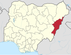 Location of Adamawa State in Nigeria | ||
| Coordinates: 9°20′N 12°30′E / 9.333°N 12.500°E / 9.333; 12.500 | ||
| Country | ||
| Established | August 27, 1991 | |
| Capital | Yola | |
| Government | ||
| • Governor | Bindo Jibrilla (APC) | |
| • Deputy Governor | Martin Babale | |
| • Senators | Ahmad Abubakar Binta Masi Garba Abdulaziz Nyako | |
| • Representatives | List | |
| Area | ||
| • Total | 36,917 km2 (14,254 sq mi) | |
| Population (2006) | ||
| • Total | 3,178,950 | |
| Time zone | UTC+1 (GMT) | |
| Geocode | NG-AD | |
| GDP (2007) | $4.58 billion[1] | |
| GDP Per Capita | $1,417[1] | |
HDI (2016) | 0.429[2] · 24th of 36 | |
| Website | www.adamawastate.gov.ng | |

Adamawa is a state in northeastern Nigeria, with its capital at Yola. In 1991, when Taraba State was carved out from Gongola State, the geographical entity Gongola State was renamed Adamawa State, with four administrative divisions: Adamawa, Ganye, Mubi and Numan. It is the home of the American University of Nigeria in Yola and Modibbo Adama University of Technology Yola. It is one of the thirty-six states that constitute the Federal Republic of Nigeria.
On May 14, 2013, President Goodluck Jonathan declared a state of emergency in Adamawa State, along with neighboring Borno State and Yobe State, due to the activities of Boko Haram.[3]
Contents
1 Geography
2 Economy
3 History
3.1 Emirs of Adamawa
3.2 Impact of Islamist insurgency
4 Sites of interest
5 Local Government Areas
6 Notable people
7 References
8 External links
Geography
Adamawa is one of the largest states of Nigeria and occupies about 36,917 square kilometres. It is bordered by the states of Borno to the northwest, Gombe to the west and Taraba to the southwest. Its eastern border forms the national eastern border with Cameroon.
Topographically, it is a mountainous land crossed by the large river valleys – Benue, Gongola and Yedsarem. The valleys of the Mount Cameroon, Mandara Mountains and Adamawa Plateau form part of the landscape.
Economy
The major occupation of the people is farming as reflected in their two notable vegetational zones, the Sub-Sudan and Northern Guinea Savannah zones. Their cash crops are cotton and groundnuts while food crops include maize, yam, cassava, guinea corn, millet and rice.
The village communities living on the banks of the rivers engage in fishing while the Fulanis are cattle rearers. The state has a network of roads linking all parts of the country.
The development of many communities in the state can be traced to the colonial era when the Germans ruled a swath of territory known as the Northern and Southern Kameruns from Dikwa in the North to Victoria (Limbe) on the Atlantic coast in the 19th century. These were, however, handed over as United Nations Trust Territories to the British at the end of the World War I with the signing of the Treaty of Versailles. After a series of referendums, the Northern Kameruns joined Nigeria to form the then Sardauna Province, and the Southern Kameruns formed a Confederation with French speaking Cameroon.
Adamawa State is home to the headquarters of two indigenous churches, the Church of the Brethren in Nigeria (EYN Church) with its headquarters in Mubi in the northern zone of the state, and the Lutheran Church of Christ in Nigeria (LCCN Church) with headquarters in Numan in the southern zone of the state. The Church of the Brethren in Nigeria (EYN church) was founded in Garkida Gombi Local Government of the state in March 1923 by American missionaries. The Lutheran Church of Christ in Nigeria (LCCN Church) was founded in Numan by Dutch missionaries in 1913.
History
Before it became a state in Nigeria, Adamawa was a subordinate kingdom of the Sultanate of Sokoto which also included much of northern Cameroon. The rulers bear the title of emir ("lamido" in the local language, Fulfulde).
The name "Adamawa" came from the founder of the kingdom, Modibo Adama, a regional leader of the Fulani Jihad organized by Usman dan Fodio of Sokoto in 1804. Modibo Adama came from the region of Gurin (now just a small village) and in 1806, received a green flag for leading the jihad in his native country. In the following years, Adama conquered many lands and tribes. In 1838, he moved his capital to Ribadu, and in 1839, to Joboliwo. In 1841, he founded Yola, where he died in 1848. After the European colonization (first by Germany and then by Britain), the rulers remained as emirs and the line of succession has continued to the present day.

Dancers of Adamawa state in their cultural adornment
Emirs of Adamawa
Emirs of Adamawa have included:
- Modibbo Adama ben Hassan, 1809–1848
- Lawalu ben Adama, 1848–1872 (son of the previous)
- Sanda ben Adama, 1872–1890 (brother of the previous)
- Zubayru ben Adama, 1890–1901 (brother of the previous)
- Bobbo Ahmadu ben Adama, 1901–1909 (brother of the previous)
- Iya ben Sanda, 1909–1910 (son of Sanda ben Adama)
- Muhammadu Abba, 1910–1924 (son of Bobbo Ahmadu ben Adama)
- Muhammadu Bello ben Ahmadu ben Hamidu ben Adamu, 1924–1928
- Mustafa ben Muhammadu Abba, 1928–1946 (son of Muhammadu Abba)
- Ahmadu ben Muhammadu Bello, 1946–1953
- Aliyu Mustafa, 1953–2010
Muhammadu Barkindo Aliyu Musdafa, 2011–present
Impact of Islamist insurgency
Adamawa State has been impacted by the Islamist insurgency in Nigeria. As of November 30, 2014, the state has become home to camps housing an estimated 35,000 internally displaced persons fleeing violence from Boko Haram in locations such as Mubi, Madagali, Askira Uba, Bama and Gwoza in the states of Adamawa, Borno, and Yobe. In 2014, an estimate placed the number of internally displaced persons around Yola at 400,000.[4] In 2017, when jihadist Fulani herdsmen attacked Christians in Demsa, it was alleged that the government sent the airforce to bomb the defending Christians and protect the aggressors.[5]
Organizations serving the community include the Adamawa Peace Initiative (API)- a group of business, religious, and community leaders- and the Adamawa Muslim Council. The United States Agency for International Development has pledged to provide continuing humanitarian assistance.[4]
A measles outbreak was reported in the camps in January 2015.[6]
Sites of interest
- Mubi
- Nuhu Auwalu Wakili's Palace
Sukur World Heritage Site- Lamido's Palace
- American University of Nigeria
- Kamale Mountain Peak in Michika
- Three Sisters Rock in Song
- The confluence of Rivers Benue and Gongola in Numan Uba under Mubi (Valanyi)
Local Government Areas
Adamawa State consists of twenty-one Local Government Areas (LGAs):
- Demsa
- Fufore
- Ganye
- Girei
- Gombi
- Guyuk
- Hong
- Jada
- Lamurde
- Madagali
- Maiha
- Mayo-Belwa
- Michika
- Mubi North
- Mubi South
- Numan
- Shelleng
- Song
- Toungo
Yola North (State capital)- Yola South
Notable people
- Abubakar Saleh Michika
- Bamanga Tukur
- Mohammed Bello
- Atiku Abubakar
- Murtala Nyako
- Boni Haruna
- Babachir David Lawal
- Nuhu Ribadu
- Buba Marwa
- Aisha Buhari
- Binta Masi Garba
- Alex Badeh
- Ibrahim Lamorde
- Ahmed Hassan Barata
References
^ ab "C-GIDD (Canback Global Income Distribution Database)". Canback Dangel. Archived from the original on March 11, 2012. Retrieved 2008-08-20..mw-parser-output cite.citation{font-style:inherit}.mw-parser-output q{quotes:"""""""'""'"}.mw-parser-output code.cs1-code{color:inherit;background:inherit;border:inherit;padding:inherit}.mw-parser-output .cs1-lock-free a{background:url("//upload.wikimedia.org/wikipedia/commons/thumb/6/65/Lock-green.svg/9px-Lock-green.svg.png")no-repeat;background-position:right .1em center}.mw-parser-output .cs1-lock-limited a,.mw-parser-output .cs1-lock-registration a{background:url("//upload.wikimedia.org/wikipedia/commons/thumb/d/d6/Lock-gray-alt-2.svg/9px-Lock-gray-alt-2.svg.png")no-repeat;background-position:right .1em center}.mw-parser-output .cs1-lock-subscription a{background:url("//upload.wikimedia.org/wikipedia/commons/thumb/a/aa/Lock-red-alt-2.svg/9px-Lock-red-alt-2.svg.png")no-repeat;background-position:right .1em center}.mw-parser-output .cs1-subscription,.mw-parser-output .cs1-registration{color:#555}.mw-parser-output .cs1-subscription span,.mw-parser-output .cs1-registration span{border-bottom:1px dotted;cursor:help}.mw-parser-output .cs1-hidden-error{display:none;font-size:100%}.mw-parser-output .cs1-visible-error{font-size:100%}.mw-parser-output .cs1-subscription,.mw-parser-output .cs1-registration,.mw-parser-output .cs1-format{font-size:95%}.mw-parser-output .cs1-kern-left,.mw-parser-output .cs1-kern-wl-left{padding-left:0.2em}.mw-parser-output .cs1-kern-right,.mw-parser-output .cs1-kern-wl-right{padding-right:0.2em}
^ "National Human Development Report 2018" (PDF).
^ "Nigeria declares 'massive' military campaign on borders". BBC News. May 15, 2013. Retrieved June 6, 2013.
^ ab "Nigeria: U.S., UK, American University Deliver Relief Materials to Adamawa Displaced Persons". Channels Television. November 20, 2014.
(subscription required)
^ "How Buhari sent Air Force to 'bomb' Christians in Adamawa – Fani-Kayode". Daily Post. 6 December 2017. Retrieved 28 December 2018.
^ Mohammed Ismail (January 16, 2015). "Nigeria: Adamawa IDPs' Camps Record Outbreak of Measles]". AllAfrica.
External links
Adamawa.com - Articles, photographs, and art from Adamawa State
Federal Capital Territory (FCT) | |
|
Coordinates: 9°20′N 12°30′E / 9.333°N 12.500°E / 9.333; 12.500


