Bulawayo
Bulawayo koBulawayo | |||
|---|---|---|---|
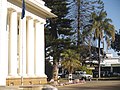
 View of Bulawayo's Central Business District (CBD) from Pioneer House by Prince Phumulani Nyoni. The CBD is 5.4 square kilometres and is in a grid pattern with 17 avenues and 11 streets. | |||
| |||
 Location in Bulawayo Province | |||
 Location in Bulawayo Province | |||
| Coordinates: 20°10′12″S 28°34′48″E / 20.17000°S 28.58000°E / -20.17000; 28.58000Coordinates: 20°10′12″S 28°34′48″E / 20.17000°S 28.58000°E / -20.17000; 28.58000 | |||
| Country | Zimbabwe | ||
| Province | Bulawayo | ||
| District | City of Bulawayo | ||
| Settled | 1840 | ||
| Incorporated (town) | 1897 | ||
| Incorporated (city) | 1943 | ||
| Divisions | 4 Districts, 29 Wards, 156 Suburbs | ||
| Government | |||
| • Type | Provincial Municipality | ||
| • Mayor | Martin Moyo | ||
| Area | |||
| • City | 1,706.8 km2 (659.0 sq mi) | ||
| • Water | 129.3 km2 (49.9 sq mi) | ||
| • Urban | 993.5 km2 (383.6 sq mi) | ||
| • Metro | 1,706.8 km2 (659.0 sq mi) | ||
| Elevation[1] | 1,358 m (4,455 ft) | ||
| Population (2016) | |||
| • City | 1,200,337 | ||
| • Density | 700/km2 (1,800/sq mi) | ||
| • Urban | 1,205,675 | ||
| • Urban density | 2,305/km2 (5,970/sq mi) | ||
| Time zone | UTC+2 (CAT) | ||
| • Summer (DST) | UTC+2 (not observed) | ||
| Area code(s) | 9 | ||
| Climate | Cwa | ||
| Website | citybyo.co.zw | ||


Bulawayo is the second-largest city in Zimbabwe with an estimated population of 1 200 337, per city council estimates in 2018. This figure is disputed with the national government saying Bulawayo and the Matabeleland region is declining in population when the rest of the country is growing rapidly. Authorities in Matabeleland say these are deliberate moves by officials in the capital to deprive the region when it comes to resource allocation.[disputed ][2] It is the capital of the Ndebele province of Matabeleland. Matabeleland is now divided into 3 regions for administration purposes with Lupane being capital of Matabeleland North province, Gwanda being capital of Matabeleland South province and the city of Bulawayo for the Bulawayo Metropolitan Province.
Bulawayo is is nicknamed the "City of Kings" or "kontuthu ziyathunqa" — a Ndebele phrase for "smoke arising". This name arose from the city's historically large industrial base and specifically draws from the large cooling towers of the coal powered electricity generating plant situated in the city centre that once used to billow steam and smoke over the city.[3] The majority of Bulawayo's population belongs to the Ndebele ethnic and language group (otherwise known as Northern Ndebele)[4].
For a long time, Bulawayo was regarded as the industrial centre of Zimbabwe, and it served as the hub to the country's rail network with the National Railways of Zimbabwe headquartered there because of its strategic position near Botswana, Zambia and South Africa.
Contents
1 History
1.1 Siege
1.2 Modern city
1.3 Bulawayo City Council
2 Geography
2.1 Topography
2.2 Climate
2.3 Water Supply
3 Demographics
3.1 Population census controversy
4 Economy
4.1 Important buildings and infrastructure
5 Government
6 Newspapers
7 Twin towns – sister cities
8 Culture and recreation
8.1 Sports
8.2 Museums
8.3 Parks
9 Transport
10 Suburbs and districts
11 Schools and colleges
11.1 Primary schools
11.2 Secondary and high schools
11.3 Schools outside Bulawayo
11.4 Colleges and universities
12 Medical care
13 Literature
14 Natives and residents
15 References
16 Bibliography
History

Inhabitant of Bulawayo, 1890

Bulawayo Scouts in 1893
The city was founded by the Ndebele king, Lobhengula, the son of King Mzilikazi born of Matshobana who settled in modern-day Zimbabwe around the 1840s after the Ndebele people's great trek from Nguniland. The name Bulawayo comes from the Ndebele word KoBulawayo meaning "a place where he is being killed". It is thought that, at the time of the formation of the city, there was a civil war. A group of Ndebeles not aligned to Prince Lobengula were fighting him as they felt he was not the heir to the throne, hence he gave his capital the name "where he (the prince) is being killed". It is said that when King Lobengula named the place "KoBulawayo" his generals asked "who is being killed mtanenkosi (prince)?" and he replied "Yimi umntwanenkosi engibulawayo", meaning "it's me, the prince, who is being killed". At the time Lobengula was a prince fighting to ascend his father's (Mzilikazi) throne. It was common at the time for people to refer to Bulawayo as "KoBulawayo UmntwaneNkosi" "a place where they are fighting or rising against the prince". The name Bulawayo is imported from Nguniland which was once occupied by the Khumalo people. The place still exists: It is next to Richards Bay.[citation needed]
In the 1860s the city was further influenced by European intrigue, and many colonial powers cast covetous eyes on Bulawayo and the land surrounding it. Britain made skillful use of private initiative in the shape of Cecil Rhodes and the Chartered Company to disarm the suspicion of her rivals. Lobengula once described Britain as a chameleon and himself as the fly.[5]
During the 1893 Matabele War, the invasion by British South Africa Company troops forced King Lobengula to evacuate his followers, after first detonating munitions and setting fire to the town.[6] BSAC troops and white settlers occupied the ruins. On 4 November 1893, Leander Starr Jameson declared Bulawayo a settlement under the rule of the British South Africa Company. Cecil Rhodes ordained that the new settlement be founded on the ruins of Lobengula's royal kraal, which is where the State House stands today. In 1897, the new town of Bulawayo acquired the status of municipality, and Lt. Col. Harry White became one of the first mayors.[7]
Siege
At the outbreak of the Second Matabele War, in March 1896, Bulawayo was besieged by Ndebele forces, and a laager was established there for defensive purposes. The Ndebele had experienced the brutal effectiveness of the British Maxim guns in the First Matabele War, so they never mounted a significant attack against Bulawayo, even though over 10,000 Ndebele warriors could be seen near the town. Rather than wait passively, the settlers mounted patrols, called the Bulawayo Field Force, under Frederick Selous and Frederick Russell Burnham. These patrols rode out to rescue any surviving settlers in the countryside and attacked the Ndebele. In the first week of fighting, 20 men of the Bulawayo Field Force were killed and 50 were wounded. An unknown number of Ndebele were killed and wounded.
During the siege, conditions in Bulawayo quickly deteriorated. By day, settlers could go to homes and buildings in the town, but at night they were forced to seek shelter in the much smaller laager. Nearly 1,000 women and children were crowded into the small area and false alarms of attacks were common. The Ndebele made a critical error during the siege in neglecting to cut the telegraph lines connecting Bulawayo to Mafikeng. This gave the besieged Bulawayo Field Force and the British relief forces, coming from Salisbury and Fort Victoria (now Harare and Masvingo respectively) 300 miles to the north, and from Kimberley and Mafeking 600 miles to the south, far more information than they would otherwise have had. Once the relief forces arrived in late May 1896, the siege was broken and an estimated 50,000 Ndebele retreated into their stronghold, the Matobo Hills near Bulawayo. Not until October 1896 would the Ndebele finally lay down their arms to the invaders.
Modern city
In 1943 Bulawayo received city status.
In recent years, Bulawayo has experienced a sharp fall in living standards coinciding with the severe economic crisis affecting the country. The main problems include poor investment, reluctance by government to improve infrastructure and corruption and nepotism leading to most original dwellers of the city migrating south to the neighbouring South Africa. Water shortages due to lack of expansion in facilities and supplies have become steadily more acute since 1992. Cholera broke out in 2008. Though the city is the centre of the southern population generally categorized as the Matebele, the composition of the city is made up of people from all over the country thereby making it the friendliest city in Zimbabwe as it is built on a foundation of tolerance and acceptance of different cultures. The Central Business District has the widest roads which were deliberately made so to accommodate the carts that were used as a primary means of transport back when the town was planned and erected.
Bulawayo City Hall
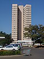
Kenilworth Towers, residential flats


Bulawayo City Council

Bulawayo City Council Offices
Although controlled by the main opposition party MDC-T, the council has managed to stand out as the leading municipality in Zimbabwe in service delivery to its residents, through campaigns engineered by the city council such as the #mycitymypride campaign and #keepbyoclean on social media. These have been met with positive responses by residents and other stakeholders in the city. In recent years, Bulawayo has been widely perceived as the cleanest city in Zimbabwe due to the council's effective waste management strategy.[citation needed]
In 2015 the city of Bulawayo was praised for its town planning that, unlike major urban areas such as Harare and Chitungwiza, has not been marred by corruption and problems such as illegal settlements. The municipality police are among the hardest working as they maintain order in the city without corruption or favour.[citation needed]
Geography

Bougainvillea outside a Bulawayo home
Topography
The city sits on a plain that marks the Highveld of Zimbabwe and is close to the watershed between the Zambezi and Limpopo drainage basins. The land slopes gently downwards to the north and northwest. The southern side is hillier, and the land becomes more broken in the direction of the Matobo Hills to the south.
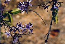
Petrea flower in a garden in Bulawayo
Climate
Due to its relatively high altitude, the city has a subtropical climate despite lying in the tropics. Under the Köppen climate classification, Bulawayo features a semiarid climate (BSh). The mean annual temperature is 19.16 °C (66.44 °F),[8] similar to Pretoria at a similar altitude but almost 600 km (373 mi) farther north. As with much of southern and eastern Zimbabwe, Bulawayo is cooled by a prevailing southeasterly airflow most of the year and experiences three broad seasons: a dry, cool winter season from May to August; a hot dry period in early summer from late August to early November; and a warm wet period in the rest of the summer, early November to April. The hottest month is October, which is usually the height of the dry season. The average maximum temperature ranges from 21 °C (70 °F) in July to 30 °C (86 °F) in October. During the rainy season, daytime maxima are around 26 °C (79 °F). Nights are always cool, ranging from 8 °C (46 °F) in July to 16 °C (61 °F) in January.
The city's average annual rainfall is 594 mm (23 in), which supports a natural vegetation of open woodland, dominated by Combretum and Terminalia trees. Most rain falls in the December to February period, while June to August is usually rainless. Being close to the Kalahari Desert, Bulawayo is vulnerable to droughts and rainfall tends to vary sharply from one year to another. In 1978, 888 mm (35 in) of rain fell in the three months up to February (February 1944 is the wettest month on record with 368mm) while in the three months ending February 1983, only 84 mm (3 in) fell.
| Climate data for Bulawayo | |||||||||||||
|---|---|---|---|---|---|---|---|---|---|---|---|---|---|
| Month | Jan | Feb | Mar | Apr | May | Jun | Jul | Aug | Sep | Oct | Nov | Dec | Year |
| Record high °C (°F) | 36.7 (98.1) | 34.4 (93.9) | 35.6 (96.1) | 33.0 (91.4) | 30.6 (87.1) | 28.3 (82.9) | 28.3 (82.9) | 32.2 (90) | 35.0 (95) | 36.7 (98.1) | 37.2 (99) | 35.2 (95.4) | 37.2 (99) |
| Average high °C (°F) | 27.7 (81.9) | 27.2 (81) | 27.1 (80.8) | 25.9 (78.6) | 24.1 (75.4) | 21.6 (70.9) | 21.5 (70.7) | 24.4 (75.9) | 27.9 (82.2) | 29.4 (84.9) | 28.7 (83.7) | 27.7 (81.9) | 26.1 (79) |
| Daily mean °C (°F) | 21.8 (71.2) | 21.2 (70.2) | 20.6 (69.1) | 18.7 (65.7) | 16.0 (60.8) | 13.7 (56.7) | 13.8 (56.8) | 16.4 (61.5) | 19.9 (67.8) | 21.6 (70.9) | 21.7 (71.1) | 21.4 (70.5) | 18.9 (66) |
| Average low °C (°F) | 16.5 (61.7) | 16.2 (61.2) | 15.3 (59.5) | 13.0 (55.4) | 9.9 (49.8) | 7.4 (45.3) | 7.2 (45) | 9.1 (48.4) | 12.4 (54.3) | 15.0 (59) | 16.0 (60.8) | 16.3 (61.3) | 12.9 (55.2) |
| Record low °C (°F) | 10.0 (50) | 9.4 (48.9) | 8.4 (47.1) | 3.5 (38.3) | 0.0 (32) | −3.9 (25) | 0.0 (32) | 0.0 (32) | 1.4 (34.5) | 6.9 (44.4) | 7.2 (45) | 8.9 (48) | −3.9 (25) |
| Average rainfall mm (inches) | 117.8 (4.638) | 104.6 (4.118) | 51.4 (2.024) | 33.3 (1.311) | 7.0 (0.276) | 2.2 (0.087) | 1.0 (0.039) | 1.4 (0.055) | 7.0 (0.276) | 38.4 (1.512) | 91.1 (3.587) | 120.3 (4.736) | 575.5 (22.657) |
| Average rainy days | 10 | 8 | 5 | 3 | 1 | 1 | 0 | 0 | 1 | 4 | 8 | 10 | 51 |
| Average relative humidity (%) | 69 | 71 | 70 | 62 | 56 | 54 | 48 | 43 | 41 | 43 | 55 | 63 | 56 |
| Mean monthly sunshine hours | 244.9 | 212.8 | 251.1 | 252.0 | 279.0 | 267.0 | 288.3 | 300.7 | 288.0 | 272.8 | 237.0 | 226.3 | 3,119.9 |
| Mean daily sunshine hours | 7.9 | 7.6 | 8.1 | 8.4 | 9.0 | 8.9 | 9.3 | 9.7 | 9.6 | 8.8 | 7.9 | 7.3 | 8.5 |
| Source #1: World Meteorological Organization[9] NOAA (sun and mean temperature, 1961–1990)[10] | |||||||||||||
| Source #2: Deutscher Wetterdienst (extremes and humidity)[11] | |||||||||||||
Water Supply
Bulawayo has good quality tap water owing to the management of the water authorities, meeting international standards . Bulawayo does not recycle waste water but uses treated waste water for irrigation.
Bulawayo experiences water shortages in drought seasons due to the overwhelming increase in population versus the static and sometimes decreasing capacity of the reserve dams. The geographical factors causing water scarcity are rising temperatures, the area's high elevation and the arid environment of Matabeleland. Bulawayo provides residents with water by using a system of dams, treatment plants, and reservoirs.
Environmental and sanitation circumstances have detrimental effects on water quality. Sources such as groundwater and tap water are subject to pollution due to waste from burst sewers contaminating them. Samples taken from well water from the Pumula and Robert Sinyoka suburbs show that well water maintain levels of coliform higher than the Standards Association of Zimbabwe and World Health Organization give.[12][13]
Demographics
Population census controversy
The population of Bulawayo, according to the 2012 national census, stood at 653,337;[14] however, this figure has been rejected by the Bulawayo City Council authority with Councillor Martin Moyo claiming an anti-Bulawayo conspiracy to under-fund projects in the city.[15][16]
The population of the city according to metropolitan council sources is closer to 1.5 million and a more closer and estimated figure being 1.2 million.[citation needed] Reports have alluded to the de-industrialization of the city as the reason for its population decline, a claim which was rubbished as council officials referred to the fact that, in 1992 the city's population stood at 620,936. It had grown in the number of households due to urban expansion. City authorities also laid claim to the fact that the current water challenges facing the city were a result of an increasing population despite its economic challenges.
| Historical population | ||
|---|---|---|
| Year | Pop. | ±% |
| 1992 | 620,936 | — |
| 2002 | 676,650 | +9.0% |
| 2012 | 653,337 | −3.4% |
| Source: Zimbabwe National Statistics Agency (ZIMSTAT) | ||
Economy
Bulawayo was known as the industrial hub of Zimbabwe. This is the reason why the Zimbabwe International Trade Fair is hosted in Bulawayo. It had a large manufacturing presence with large industries based here before Zimbabwe's economic collapse. However, some of these companies have either moved operations to Harare or have closed down — which has crippled Bulawayo's economy. Most factories are deserted and the infrastructure has since been left to deteriorate. The reason for the de-industrialization has largely been political with some factories like Gold Star sugar company removing machinery that was installed during colonial times to open new factories in Harare . When Government passed Indegenisation laws some successful businesses were taken over by Zanu PF people only to close down a fews years later.
Many locals argue that it is because of marginalisation they experience against the government due to cultural differences between the Shona in Harare and the Ndebele in Bulawayo because the National railways of Zimbabwe (headquarters in Bulawayo) is a government parastatal and, as such, should have been thriving had it not been for embezzlement of funds by company executives who are believed to be Shona. The water issue is not new and had brought about the "help a thirsty Matabele" initiative of the 1970s and the Matabeleland Zambezi Water Project which would put an end to the water issue in Matabeleland was drafted; however, this project was put on hold soon after independence.
These allegations have all been labeled hogwash by the relevant authorities. However, they have only fueled the secessionist initiative into a general opinion. The city still contains most of what remains of Zimbabwe's heavy industry and food processing capability. This includes a thermal power station that resumed operations in February 2011 after a capitalisation deal with the Government of Botswana where Bulawayo would supply 45 megawatts in three years.
Like many parts of the country, Bulawayo has for the past ten years[when?] seen a huge drop in service delivery and an increase in unemployment due to the resignations of people seeking better prospects across the border. Many people resorted to farming, mining, and the black market for sustenance, while others depended on the little foreign currency that would be sent by family in other countries. However, with the introduction of the multi-currency system in 2009, a new approach is seen by investors in the city who admire the already-available infrastructure; the huge workforce; and Bulawayo as great prospects. It is set to once again contribute greatly to the economy of Zimbabwe.
The city is served by Joshua Mqabuko Nkomo International Airport and the other international airport in the region being the Victoria Falls International Airport. Bulawayo is the capital of the bigger Matabeleland province which is arguable Zimbabwe's tourism paradise. Matabeleland boosts of Victoria Falls, Matopo National Park, Hwange National Park, Khami Ruins and a bigger share of Lake Kariba . The city is located within an excellent road and rail transport network linking the region to South Africa, Botswana, Zambia and Mozambique. The potential is massive and Bulawayo will rise again.

The Bulawayo Centre
Important buildings and infrastructure

The Nesbitt Castle, Bulawayo
These include:
- Ascot Centre
- Bulawayo Centre
- Bulawayo Golf Club
- Fidelity Life Centre
- Mhlahlandlela Government Complex
- Nesbitt Castle
- NRZ building
- National University of Science and Technology
Government
Bulawayo is governed by the Bulawayo City Council, which is headed by the Mayor of Bulawayo.
Newspapers
- B-Metro
- The Chronicle
- Newsday
- Southern Eye
- The Sunday News
- The Sunday Times
- Umthunywa
Twin towns – sister cities
Bulawayo is twinned with:
 Aberdeen, United Kingdom
 Durban, South Africa
Polokwane, South Africa
 Katima Mulilo, Namibia
 Francistown, Botswana
 Livingstone, Zambia
Culture and recreation
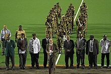
Opening ceremony of the African Olympic Hockey Qualifiers 2011, Khumalo Hockey Stadium
Sports
Bulawayo is home to the Queens Sports Club and Bulawayo Athletic Club, two of the three grounds in Zimbabwe where test match cricket has been played.
Bulawayo Golf Club, the first golf club in the city and country was established in 1895. The Matsheumhlope river cuts through the 18 hole course in the suburbs.
It is home to Hartsfield Rugby grounds where many international Test matches have been played. Hartsfield was developed by Reg Hart, after whom the grounds were named and on which field many of southern Africa's greatest rugby players have competed. It is home to two large football teams: Highlanders and Zimbabwe Saints. Other football teams include Bantu Rovers, Chicken Inn, How Mine, Quelaton, and Bulawayo City (R).

Natural History Museum of Zimbabwe
Other important sporting and recreational facilities include
- Barbourfields Stadium
- Zimbabwe International Trade Fair Grounds
- Kumalo Hockey Stadium
- Ascot Racecourse
- Khami Ruins
- White City Stadium
- karate centers

Centinary Park
Museums
Bulawayo has museums of national importance, including the Natural History Museum of Zimbabwe, National Gallery, Bulawayo and the Bulawayo Railway Museum.
Parks
There are a number of parks in Bulawayo, including
- Centenary Park (which includes an amphitheatre, lawns and a large fountain)
- Barham Green
- Hillside Dams Conservancy (which has a number of dams within it)
- Mabukweni
Transport

14A class Engine no 515 on Ash Spur shunt, Bulawayo Station
The city has a total road network of about 2100 kilometres; 70 percent was declared in 2017 in a poor condition.[17] The R2 road links Bulawayo with the Capital Harare.
The city has Bulawayo Station on the Harare-Gaborone main line and the Beitbridge Bulawayo Railway.
On the 1 November 2013, a new terminal of Joshua Mqabuko Nkomo International Airport, formerly known as Bulawayo Airport, was opened.[18]
Suburbs and districts
| No | Suburb/location | Origin of name |
|---|---|---|
| 1 | Ascot | Adjoining the Bulawayo Ascot race-course |
| 2 | Barbour Fields | The suburb was named after a former mayor, H. R. Barbour, who during the colonial era was greatly interested in the welfare of the indigenous people. There is a place called Barbour in Argyll & Bute. Barbour is a Scottish family name, though it was apparently first recorded on the English side of the border, in Cumberland and Northumberland. The father of Scottish vernacular poetry, John Barbour (1320–1395), is best remembered for his epic poem "The Brus", telling the story of King Robert I. The origin of the name is occupational (a cutter of hair as well as an extractor of teeth during the Middle Ages). |
| 3 | Barham Green | The suburb was named after two people. The first was a former Bulawayo City Councillor (who later became an Alderman) Mrs. M. E. Barham, M.B.E. and the other was Rev. Rufus Green. They were critical in the establishment of this suburb. During the colonial Rhodesia era, it was designated for the Coloured community. |
| 4 | Beacon Hill | Also known as Beryl Drive, reference is made to fact that it is the high point of the suburbs and possesses the areas with the highest marking beacon at its summit. |
| 5 | Bellevue | The suburb was named after the estate name. It is sometimes spelled Belle Vue. The origin of this universally popular place name is ultimately French – "beautiful view". |
| 6 | Belmont | |
| 7 | Belmont Industrial Area | The area was named after a former Bulawayo City Engineer, Mr. Kinmont. |
| 8 | Bradfield | The suburb was named after Edwin Eugene Bradfield, a pioneer. |
| 9 | Burnside | This area used to be a portion of former town council area and used to be part of Matsheumhlope Farms. The name is derived from the reference to the River Matsheumhlophe. "Burn" is a Scottish and northern English word for a stream. |
| 10 | Cement | This was named after the surrounding industrial area, responsible for the making of cement. |
| 11 | Cowdray Park | |
| 12 | Donnington | |
| 13 | Donnington West | |
| 14 | Douglasdale | The Douglas family, descendants of William de Duglas (late 12th century), was one of the most powerful in Scotland. |
| 15 | Eloana | |
| 16 | Emakhandeni | Emakhandeni is the isiNdebele name for Fort Rixon, which was the area where the regiment aMakhanda were located. eMakhandeni is the locative term. |
| 17 | Emganwini | Reference is made to the plentiful amarula trees in the vicinity. |
| 18 | Enqameni | |
| 19 | Enqotsheni | |
| 20 | Entumbane | This is where King Mzilikazi was buried. It is one of the dozens of high-density suburbs of Bulawayo, commonly referred to as the "Western Suburbs". The first disturbances that led to the Gukurahundi were sparked in Entumbane, hence the term "Impi ye Ntumbane" that refers to the disturbances. |
| 21 | Estate name | |
| 22 | Estate name | |
| 23 | Fagadola | |
| 24 | Famona | The suburb was named after Famona, one of the daughters of King Lobengula. It means jealousy or envy must end (literally, "die"). |
| 25 | Fortunes Gate (including Mtaba Moya) | The suburb's name comes from the original property name, and the gates are those of the original market building. |
| 26 | Four Winds | The suburb name comes from the original property name; the first house was on top of a hill. |
| 27 | Glencoe | This name is etched into the Scottish psyche as the bleak glen in the Highlands where, in 1692, a party of MacDonald men, women, and children were treacherously massacred by the Campbells, who were acting under government orders. |
| 28 | Glengary | The suburb was named after its estate name. The "Glengarry" bonnet is an oblong woollen cap, popular amongst pipe bands. |
| 29 | Glenville (including Richmond South) | The suburb was named after its estate name. |
| 30 | Granite Park | |
| 31 | Greenhill | The suburb's name is a reference to scenery and topography. |
| 32 | Gwabalanda | Named after a Ndebele chief, Gwabalanda Mathe. |
| 33 | Harrisvale | |
| 34 | Helenvale | |
| 35 | Highmount | |
| 36 | Hillcrest | The suburb's name comes from the reference to topography. It is Greenhill's crest. |
| 37 | Hillside | The suburb's name is a reference to topography (Greenhill's slope). |
| 38 | Hillside South | The suburb's name comes from its position as the south facing slope of Greenhill. |
| 39 | Hume Park | "Hume"/"Home" is a Lowland Scottish family name. |
| 40 | Hyde Park | The name originates from the large number of residents who trace their ancestry to England. |
| 41 | Ilanda | Ndebele name for the egret |
| 42 | Iminyela | This is the name of a type of tree common in the area. |
| 43 | Intini | The name was given as a commemoration to the Mhlanga family, who originally set out with the Khumalo family under Mzilikazi as gratitude to their contribution to the Ndebele Kingdom, Mthwakazi. The Ntini is the totem of the Mhlanga-Mabuya clan. |
| 44 | Jacaranda | This is a reference to the jacaranda trees. |
| 45 | Kelvin (Industrial area, includes North East and West) | The area was named in reference to a suburb of Glasgow. It takes its name from the River Kelvin, a tributary of the River Clyde. |
| 46 | Kenilworth | The suburb was named after its estate name. |
| 47 | Khumalo | The suburb was named after the Royal Clan of the Matabele. The Khumalo hockey stadium is here. |
| 48 | Khumalo North | This is a reference to the position of Kumalo suburb. |
| 49 | Kilallo | |
| 50 | Killarney | |
| 51 | Kingsdale | |
| 52 | Lakeside | Lakeside is the stretch of water at the junction of the Old Essexvale Road and the road to the suburb of Waterford, and then on to Hope Fountain Mission. |
| 53 | Lobhengula | It is named after the second and last Matabele King, Lobengula. |
| 54 | Lobenvale | The suburb's name is derived from a combination of King Lobengula's name and Umguza Valley. |
| 55 | Lochview | The suburb's name is in reference to Lakeside Dam and is famous in the city for its large Scottish residents and the Scottish style houses. According to the Bulawayo City Suburb Names website, the suburb was named in reference to Lakeside Dam. |
| 56 | Luveve | Named after Ndebele chief Luveve; established in 1935 |
| 57 | Mabuthweni | The suburb's name means "where the soldiers are"; the name was given in reference to a bachelors' quarters. |
| 58 | Magwegwe | The suburb name is named after Magwegwe, who was one of the significant people in King Lobengula's royal Bulawayo town. |
| 59 | Magwegwe North | This is a reference to the position relative to that of Magwegwe. |
| 60 | Magwegwe West | This is a reference to the position relative to that of Magwegwe. |
| 61 | Mahatshula | Mahatshula is named after one of the Ndebele Indunas, Mahatshula Ndiweni. |
| 62 | Makhokhoba | The suburb got its name from the actions of Mr. Fallon, who used walk around with a stick. The name comes from the word "umakhokhoba" which was how the locals referred to Fallon, meaning "the little old man who walks with a stick". The word actually describes the noise of the stick hitting the ground, ko-ko-ko, or the doors. It is the oldest African dwelling in the city. Political activism was rife in the pre-Zapu era. |
| 63 | Malindela | The suburb was named after the mother of Faluta, who was the mother of Lobengula, i.e., after Lobengula's maternal grandmother. |
| 64 | Manningdale | It is named after the developer of the suburb. |
| 65 | Marlands | |
| 66 | Matsheumhlope | The name comes from the association with the river ("White Stones"). White stones in Ndebele Proper and Zulu language are "amatshe amhlope". |
| 67 | Matshobana | The suburb was named after Matshobana, who was a chief of the Khumalo clan and more significantly he was the father of Mzilikazi, the founder of the Ndebele Kingdom. |
| 68 | Montgomery | It is named after Bernard Montgomery, 1st Viscount Montgomery of Alamein, a decorated British Army commander. |
| 69 | Montrose | The suburb was named by the estate developers, and street names are of many Cotswolds villages and towns. |
| 70 | Morningside | |
| 71 | Mphophoma | The name comes from a descriptive Ndebele name for the area, which was derived from the sound the Mpopoma River makes when flowing. |
| 72 | Munda | The Tonga name for a plot of land on which people would farm |
| 73 | Mzilikazi | The suburb was named after the founder of uMthwakazi, King Mzilikazi. It is a stone's throw away from Barbourfields suburb, separated by a road called Ambulance Drive that leads to one of Zimbabwe's large hospitals, Mpilo. |
| 74 | New Luveve | Reference is made to the suburb Luveve; see Luveve suburb. |
| 75 | Newsmansford | |
| 76 | Newton | Estate name |
| 77 | Newton West | Reference to position (Newton) |
| 78 | Nguboyenja | Named after Lobengula's son and heir |
| 79 | Njube | Named after one of Lobengula's sons |
| 80 | Nketa | It is named after the traditional heritage site of Nketa Hill on which King Lobengula assembled his entire kingdom and divided its citizens according to cultural ethnicity and stages of incorporation into three groups: the Zansi which is Xhosa for "south", referring to the people who left the Zulu Kingdom originally; the Enhla or Nxele, which referred to the second mass incorporated group, which was the Swati, Pedi, and Sotho, with whom they settled in Mhlahlandela 1; the final group was the Hole /ˈxɒli, which constituted of the Shona, Kalanga and Bakwena. Most historians argued that this was clear evidence of Lobengula's lack of foresight and political tact as he was literally undoing what his father had spent his lifetime trying to achieve: a unified kingdom with a single identity. |
| 81 | Nkulumane | One of the sons of King Mzilikazi and heir, founder of the Matebele kingdom |
| 82 | North End | Reference to the direction of the suburb |
| 83 | North Lynne | |
| 84 | North Trenance | Reference to position relative to that of Trenance |
| 85 | Northlea | |
| 86 | Northvale | Former town council area; reference to position and (Umguza) valley |
| 87 | Ntaba Moyo | |
| 88 | Orange Grove | |
| 89 | Paddonhurst | Named after Major Cecil Paddon, O.B.E. (pioneer) |
| 90 | Parklands | Estate name; Park Lands estate A (portion of original grant to Dominican Sisters) |
| 91 | Parkview | Situated on the location adjacent to the Centenary Park and proposed location of Bulawayo Zoo |
| 92 | Phelandaba | Phelandaba translates as "the matter is concluded", a reference to the successful conclusion to the struggle for security. |
| 93 | Phumula | Phumula means "a resting place", reference to the fact that many have built homes there to retire to. |
| 94 | Phumula South | Named in reference to relative position of Pumula |
| 95 | Queens Park | A reference to the Queen and the three main roads – Victoria, Alexandra and Elizabeth |
| 96 | Queens Park East | A reference to the position relative to that of Queen Park |
| 97 | Queens Park West | A reference to the position relative to that of Queen Park |
| 98 | Queensdale | |
| 99 | Rangemore | The suburb adopted the original estate name. |
| 100 | Raylton | The suburb adopted the original estate name. |
| 101 | Richmond | |
| 102 | Riverside | Derived from the original estate name, which was in reference to the Umguza River |
| 103 | Romney Park | The suburb was named after George Romney, a British painter. |
| 104 | Sauerstown | Named after Dr. Han Sauer, original owner of the land |
| 105 | Selbourne Park | Named after the main road of Selbourne Avenue, now called L. Takawira Avenue, facing Ascot Mansions |
| 106 | Sizinda | Battle regiment of Mzilikazi of the Matabele |
| 107 | Southdale | |
| 108 | Souththwold | The suburb was named by the estate developers, and street names are of many Cotswolds villages and towns. |
| 109 | Steeldale | Composite name referring to industry |
| 110 | Suburbs | This was the first suburb in Bulawayo and retained that name. The suburb has many tree-lined avenues and is where the Centenary Park, Natural History Museum and the Bulawayo Athletic Club are found. |
| 111 | Sunninghill | After British royal residence (given to present Queen at time of marriage) |
| 112 | Sunnyside | Chosen from list of suggested names |
| 113 | Tegela | The name is derived from a Ndebele word ukwethekela meaning "to visit". |
| 114 | The Jungle | |
| 115 | Thorngrove | The suburb's name came from the large number of mimosa (thorn) trees in the area. |
| 116 | Trenance | |
| 117 | Tshabalala | This is the "isibongo" or praise name for Lobengula's mother, Fulata, who was of Swazi extraction. |
| 118 | Tshabalala Extension | Extension in reference to the suburb of Tshabalala |
| 119 | Umguza Estate | Named after the Umguza River which runs through it |
| 120 | Upper Rangemore | Name in reference to Rangemore suburb |
| 121 | Waterford | |
| 122 | Waterlea | |
| 123 | West Somerton | |
| 124 | Westgate | |
| 125 | Westondale | |
| 126 | Willsgrove | |
| 127 | Windsor Park | Named after English town or Guildford Castle grounds |
| 128 | Woodlands | Chosen from a list of suggested names |
| 129 | Woodville | |
| 130 | Woodville Park |
- Retained the old estate name.[19][20]
Schools and colleges
In Bulawayo, there are 128 primary and 48 secondary schools.[21]
Primary schools
| No. | School Name |
|---|---|
| 1. | Amaswazi Primary School |
| 2. | Amaveni Primary School |
| 3. | Babambeni Primary School |
| 4. | Baines Infant School |
| 5. | Baines Junior |
| 6. | Barham Green Primary School |
| 7. | Carmel Primary School |
| 8. | Coghlan Primary School |
| 9. | Dominican Convent Primary School, Bulawayo |
| 10. | Dumezweni Primary School |
| 11. | Emakhandeni Primary School |
| 12. | Fairbridge Primary School |
| 13. | Fusi Primary School |
| 14. | Gampu Primary School |
| 15. | Godlwayo Primary School |
| 16. | Helemu Primary School |
| 17. | Henry Low Primary School |
| 18. | Hillside Infant School |
| 19. | Hillside Junior School |
| 20. | HQ 1 Brigade Primary School |
| 21. | Hugh Beadle Primary School |
| 22. | Induba Primary School |
| 23. | Infant School |
| 24. | Ingubo Primary School |
| 25. | Ingwegwe Primary School |
| 26. | Inkanyezi Primary School |
| 27. | Insukamini Primary School |
| 28. | Intunta Primary School |
| 29. | Inzwananzi Primary School |
| 30. | John Slaven Primary School |
| 31. | Josiah Chinamano Primary School |
| 32. | King George VI Memorial School |
| 33. | Kumalo Primary School |
| 34. | Lobengula Primary School |
| 35. | Lobengula Primary School |
| 36. | Lochview Primary School |
| 37. | Losikeyi Primary School |
| 38. | Lotshe Primary School |
| 39. | Lukhanyiso Primary School |
| 40. | Luveve Primary School |
| 41. | Mabhukudwana Primary School |
| 42. | Mafakela Primary School |
| 43. | Mafela Primary School |
| 44. | Magwegwe Primary School |
| 45. | Mahlabezulu |
| 46. | Mahlathini Primary School |
| 47. | Malindela Primary School |
| 48. | Manondwana Primary School |
| 49. | Manyewu Primary School |
| 50. | Maphisa Primary School |
| 12. | Masiyephambili Junior School |
| 51. | Masuku Primary School |
| 52. | Maswazi Primary School |
| 53. | Matshayisikova Primary School |
| 54. | Mawaba Primary School |
| 55. | Mazwi Primary School |
| 56. | Mbizo Primary School |
| 57. | McKeurten Primary School |
| 58. | Mganwini Primary School |
| 59. | Mgiqika Primary School |
| 60. | Mgombane Primary School |
| 61. | Mhali Primary School |
| 62. | Milton Junior School |
| 63. | Mkhithika Primary School |
| 64. | Moray Primary School |
| 65. | Mpumelelo Primary School |
| 66. | Mthombowesizwe Primary School |
| 67. | Mtshane Primary School |
| 68. | Mtshede Primary School |
| 69. | Mtshingwe Primary School |
| 70. | Mzilikazi Primary School |
| 71. | Newmansford Primary School |
| 72. | Ngwalongwalo Primary School |
| 73. | Nketa Primary School |
| 74. | Nkulumane Primary School |
| 75. | Ntabeni Primary School |
| 76. | Ntshamathe Primary School |
| 77. | Nyamande Primary School |
| 78. | Petra Primary School |
| 79. | Phelandaba SDA Primary School |
| 80. | Queen Elizabeth II Primary School |
| 81. | Rangemore Primary School |
| 82. | Robert Tradgold Primary School |
| 83. | Rose Camp Primary School |
| 84. | Senzangakhona Primary School |
| 86. | Sigombe Primary School |
| 87. | St. Bernards R.C Primary School |
| 88. | St. Patricks R.C Primary School |
| 89. | St. Thomas Aquinas Primary School |
| 90. | Tategulu Primary School |
| 91. | Tennyson Primary School |
| 92. | Thembiso Primary School |
| 93. | Thomas Rudland Primary School |
| 94. | Trenance Primary School |
| 95. | Waterford Primary School |
| 96. | Whitestone School |
| 97. | Woodville Primary School |
| 98. | Zulukandaba Primary School |
Secondary and high schools
Schools outside Bulawayo
Falcon College – outskirts of Bulawayo, Esigodini
Plumtree School – 88 km (55 miles) from Bulawayo, in Plumtree- John Tallach High School
Inyathi High School – 70 km from Bulawayo- St James girls high -nyamandlovu 80 miles from Bulawayo
- George Silundika
- Mtshabezi High School
Colleges and universities
- Academy of Learning Business Training College
- ADAS Tuition Centre – ITEC registered beauty school and BTEC (EDEXCEL) Centre
- Bulawayo Polytechnic College
- Gwanda State University, Gwanda
- Hillside Teachers College
- Lupane State University, Lupane
- National University of Science and Technology, Zimbabwe
- Solusi University
- Speciss College
- UNISA
United College of Education (UCE)
Zimbabwe Distance Education College (Zdeco)- ZOU, Zimbabwe Open University
CUZ, Catholic University of Zimbabwe (CUZ)
Zimbabwe School of Mines (ZSM)[22]
Medical care
The Mater Dei Hospital is located in Bulawayo.[23]
Other hospitals located in Bulawayo include Ingutsheni Hospital, United Bulawayo Hospital (UBH)[24] Lady Rowell Martenity Hospital, Robbie Gibson Infectious Diseases Hospital, Bulawayo Central Hospital, Mpilo Central Hospital, Richards Morris, Orthopaedic Centre, All Saints Children's Hospital, PSMAS Hillside Hospital and Nervous Disorders Hospital.
Literature
The city of Bulawayo serves as the backdrop for the French novel Sale Hiver à Bulawayo, by Soline de Thoisy (2011). It is the starting point for the 1925 novel by Agatha Christie, The Secret of Chimneys, in which the main character is leading tours and meets up with an old friend who gives him two jobs to do in England.
Natives and residents
John H Abeles, physician, medical investor, philanthropist
Marshall P. Baron, painter
Erich Bloch, economist and columnist
Robin Brown, cricketer
NoViolet Bulawayo, writer
Warren Carne, cyclist
Futurelove Sibanda, entertainer
Charlene, Princess of Monaco, wife of Albert II, Prince of Monaco
Brian Chikwava, writer and musician
Charles Coghlan, lawyer, first Premier of Southern Rhodesia; honoured by burial near Cecil Rhodes's grave, at "World's View" in the Matopo Hills near Bulawayo
David Coltart, former Minister of Education, Sports, Arts and Culture (2008–2013)
Charles Coventry, cricketer
Kirsty Coventry, world-record swimmer
Chelsy Davy, former girlfriend of Prince Harry
Graham Edwards, cricketer
Lucia Evans, winner of the 2006 Irish TV talent show You're A Star, born in Bulawayo
Stanley Fischer, governor of the Bank of Israel
Duncan Fletcher, cricketer, former coach of England national cricket team and current coach of Indian national cricket team
Norman Geras, professor of political philosophy, University of Manchester; writes normblog, a widely read UK blog
Humphrey Gibbs, GCVO, KCMG, farmer, Governor of the colony of Southern Rhodesia (1959–1970)
Graeme Hick, Zimbabwean-born English cricketer
Kubi Indi, development activist and businesswoman
Oscar Bonginkosi Mdlongwa, Zimbabwean recording artist, DJ, record producer and businessman based in South Africa.
Tendayi Jembere, actor
Graham Johnson, pianist, recognised as one of the world's leading vocal accompanists; world authority on the song repertoire
Doris Lessing, novelist, recipient of the Nobel Prize in Literature
Cont Mhlanga, playwright and founder of Amakhosi Theater
August Musarurwa, composer of the tune "Skokiaan"
Benjani Mwaruwari, footballer and former Zimbabwe team captain; also played for Portsmouth FC
Peter Ndlovu, footballer, former Zimbabwe team captain; considered to be the best Zimbabwean player of all time
Lewin Nyatanga, Zimbabwean-born Welsh footballer
Alexander Pines, professor of chemistry, University of California, Berkeley
Nick Price, former world number one golfer, World Golf Hall of Fame member
Ramadu, musician
Surendran Reddy, musician, composer and performer
Rozalla, dance music performer
Ron Sandler, CEO of Lloyd's of London; chairman of Northern Rock bank
Allan Savory, biologist
Shingai Shoniwa, rock musician
Alexander McCall Smith, CBE, FRSE, writer and Emeritus Professor of Medical Law at the University of Edinburgh, Scotland; author of The No. 1 Ladies' Detective Agency series
Joseph Sonnabend, physician, researcher, part of the team which discovered interferon
Heath Streak, cricketer and former captain of Zimbabwe team; current bowling coach of the Bangladesh team
Yvonne Vera, award-winning author
Mike Williams, rugby player
Sean Williams, Zimbabwean cricketer
Sizwakele Ndlovu, TV & Radio Presenter, Voice-over artiste, MC, Public speaking coach
References
^ Google Earth
^ "Zimbabwe National Statistics Agency". zimstat.co.zw. 27 Oct 2018. Retrieved 2018-10-27..mw-parser-output cite.citation{font-style:inherit}.mw-parser-output q{quotes:"""""""'""'"}.mw-parser-output code.cs1-code{color:inherit;background:inherit;border:inherit;padding:inherit}.mw-parser-output .cs1-lock-free a{background:url("//upload.wikimedia.org/wikipedia/commons/thumb/6/65/Lock-green.svg/9px-Lock-green.svg.png")no-repeat;background-position:right .1em center}.mw-parser-output .cs1-lock-limited a,.mw-parser-output .cs1-lock-registration a{background:url("//upload.wikimedia.org/wikipedia/commons/thumb/d/d6/Lock-gray-alt-2.svg/9px-Lock-gray-alt-2.svg.png")no-repeat;background-position:right .1em center}.mw-parser-output .cs1-lock-subscription a{background:url("//upload.wikimedia.org/wikipedia/commons/thumb/a/aa/Lock-red-alt-2.svg/9px-Lock-red-alt-2.svg.png")no-repeat;background-position:right .1em center}.mw-parser-output .cs1-subscription,.mw-parser-output .cs1-registration{color:#555}.mw-parser-output .cs1-subscription span,.mw-parser-output .cs1-registration span{border-bottom:1px dotted;cursor:help}.mw-parser-output .cs1-hidden-error{display:none;font-size:100%}.mw-parser-output .cs1-visible-error{font-size:100%}.mw-parser-output .cs1-subscription,.mw-parser-output .cs1-registration,.mw-parser-output .cs1-format{font-size:95%}.mw-parser-output .cs1-kern-left,.mw-parser-output .cs1-kern-wl-left{padding-left:0.2em}.mw-parser-output .cs1-kern-right,.mw-parser-output .cs1-kern-wl-right{padding-right:0.2em}
^ "Industrial empire Bulawayo reduced to a ghost town". mg.co.za. Retrieved 30 July 2014.
^ "isiNdebele for beginners. Northern Ndebele language in Africa". www.northernndebele.blogspot.com.
^ A.R.C.B. (1961). "Review: A Russian Look at Rhodesia". The Journal of African History. 2 (1): 161–162. doi:10.1017/s0021853700002279.
^ Thorpe, C. Limpopo to Zambesi, London 1951 p.51
^ "D.S.O." London Gazette. 19 April 1901. Retrieved 24 November 2013.
^ GISS Climate data, Average annual temperature 1971 to 2001
^ "World Weather Information Service – Bulawayo". World Meteorological Organization. Retrieved 25 October 2015.
^
"Bulawayo Airport Climate Normals 1961–1990". National Oceanic and Atmospheric Administration. Retrieved 10 June 2016.
^
"Klimatafel von Bulawayo (Goetz-Observatorium) / Simbabwe" (PDF). Baseline climate means (1961–1990) from stations all over the world (in German). Deutscher Wetterdienst. Retrieved 13 May 2016.
^ Nyemba, Anesu; Manzungu, Emmanuel (2010). "The impact of water scarcity on environmental health in selected residential areas in Bulawayo City, Zimbabwe". www.sciencedirect.com. 35: 823–827. doi:10.1016/j.pce.2010.07.028. Retrieved Nov 11, 2016.
^ Nyemba, Anesu. "The impact of water scarcity on environmental health in selected residential areas in Bulawayo City, Zimbabwe." Physics and chemistry of the earth 35.13 (2010):823–827. Web.
^ "Provincial Report – Bulawayo" (PDF). Archived from the original (PDF) on 9 September 2015. Retrieved 4 May 2016.
^ "Bulawayo Census Outrage". chronicle.co.zw. Retrieved 4 May 2016.
^ "Storm Over Bulawayo Census Results". thestandard.co.zw. Retrieved 4 May 2016.
^ "70% of Bulawayo roads dilapidated". bulawayo24.com. 12 Feb 2017. Retrieved 17 May 2017.
^ "Joshua Mqabuko Nkomo International Airport opens". bulawayo24.com. 2 November 2013. Retrieved 17 May 2017.
^ Technologies, Numo Uno. "Bulawayo 1872.com :::: Southern African home". www.bulawayo1872.com.
^ "Scottish Place Names - Bulawayo, Zimbabwe". www.rampantscotland.com.
^ Makoni, Albert (6 September 2007). "Health disaster looms in Bulawayo". The Zimbabwe Guardian. Archived from the original on 26 December 2007. Retrieved 22 November 2007.
^ Zimbabwe School of Mines. Zimbabwe School of Mines http://www.zsm.ac.zw/zsmsite/index.php. Retrieved 19 April 2018. Missing or empty|title=(help)
^ "New cardiology intervention introduced at Mater Dei Hospital". The Malta Independent. December 2, 2017. Retrieved December 9, 2017.
^ United Bulawayo Hospitals. United Bulawayo Hospitals http://www.ubh.org.zw/. Retrieved 19 April 2018. Missing or empty|title=(help)
Bibliography
| Wikimedia Commons has media related to Bulawayo. |
| Wikivoyage has a travel guide for Bulawayo. |
Authority control |
|
|---|


